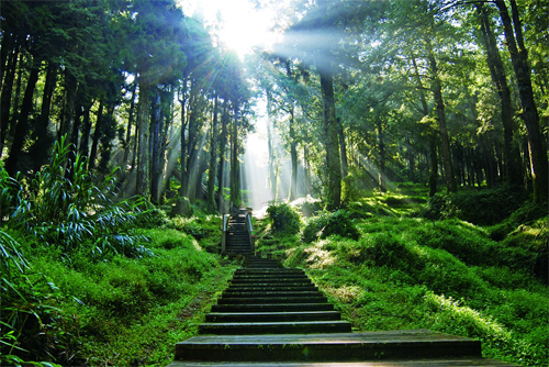
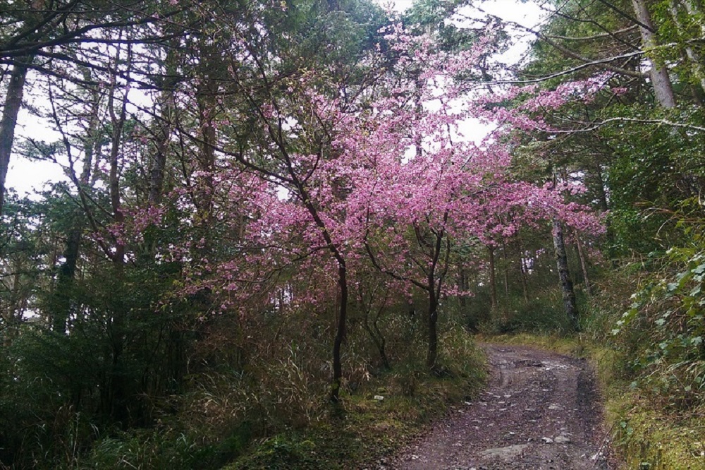
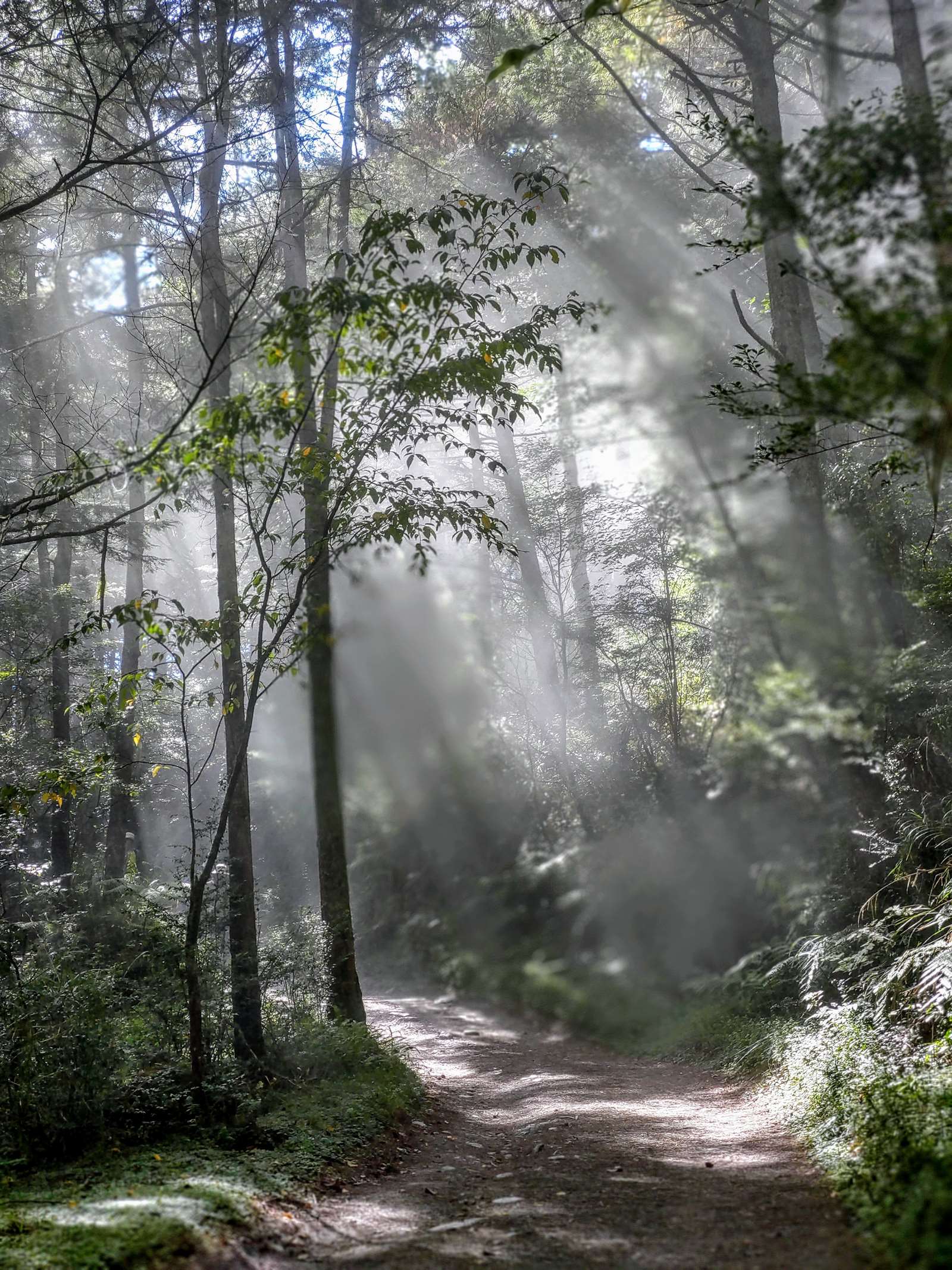
Strolling on the winding forest trail amidst the neatly-arranged Taiwan Red Pine and Taiwan Red Cypress, from time to time, you may encounter mountaineers with huge backpacks. As you greet each other, a Mikado Pheasant may quietly pass through the trail behind you and disappear into the bushes, while the Taiwan Firecrest in the tree never stops chirping. This is a typical scene for those who pay a visit to Siangyang (Sunward) National Forest Recreation Area.
Compared to the renowned Jiaming Lake, Siangyang National Forest Recreation Area located at the 154K marker of the Southern Cross-island Highway (Provincial Highway No. 20) at an altitude of 2,320 meters with just the right size, appears to be much more low-profiled. There is gorgeous artificial forest along with gentle trails. A walk along the trails in the Recreation Area grants one the music of a dozen mountain birds singing and the pictures of roaming national treasures, Mikado Pheasant, as well as the sneaky Formosan Muntjac and goats. It is indeed a pleasant environment at high elevation with cool temperature, neat forestation, and rich ecology for anyone to go on a carefree hiking for half a day!
Note: Siangyang National Forest Recreation Area is currently closed. The reopening date will be announced separately.
06/21 Sun.
Closed
17°
14° / 20°
More
Weather Forecast
|
09.16
Thur.
|
09.17
Fri.
|
09.18
Sat.
|
09.19
Sun.
|
09.20
Mon.
|
09.21
Tue.
|
09.22
Wed.
|
|
|---|---|---|---|---|---|---|---|
| Temperature |
14 ° / 20 °
|
13 ° / 21 °
|
13 ° / 21 °
|
13 ° / 22 °
|
13 ° / 22 °
|
13 ° / 21 °
|
13 ° / 21 °
|
| Feel like | 14 ° / 21 ° | 13 ° / 22 ° | 13 ° / 22 ° | 13 ° / 23 ° | 13 ° / 23 ° | 12 ° / 22 ° | 12 ° / 22 ° |
|
Probability of Precipitation |
20 % | 50 % | 70 % | - | - | - | - |
| Relative Humidity | 86 % | 86 % | 88 % | 84 % | 85 % | 81 % | 81 % |
|
Wind speed Wind direction |
2
NW
|
2
N
|
2
SW
|
2
NE
|
2
SW
|
2
N
|
2
N
|
| UVI |
10
Very High
|
10
Very High
|
10
危險級
|
11
危險級
|
11
危險級
|
11
危險級
|
11
危險級
|
|
Sunrise Sunset |
|
|
|
|
|
|
|
Central Weather Bureau|Update Time:2021/09/16 11:18
Haiduan Township, Taitung County
Siangyang National Forest Recreation Area
Admission Fees
Entry Service Point (Control Point)
| Ticket Type | Price (NT$) | Description |
|---|---|---|
|
Ticket Type
No Charge Required
|
Price (NT$)
0
|
Description
Closed
|
Travel Information
Opening Hours
Park Closed
The park is closed due to engineering planning.
There is no parking space, toilets, trash cans, or tourist group injury insurance. Due to unstable geology along the Nanheng Highway, please assess the safety risks of your visit and reserve time for your return trip.
Please do not enter the work area or closed area. The park is only for Songjing and Songtao trails to connect to Jiaming Lake National Trail (on-site registration is required, registration time is 07:00-16:00, not accepted during New Year's Eve, heavy rain, typhoon, earthquake and other disaster periods and after disasters). If the itinerary exceeds 2.7 kilometers of Jiaming Lake National Trail, please apply on the official website of Jiaming Lake National Trail (https://jmlnt.forest.gov.tw/) and the Ministry of the Interior National Police Agency (https://nv2.npa.gov.tw/NM107-604Client/) before you can go.
It is difficult to decompose and remove garbage in high mountain environments. Please implement Leave No Trace (LNT) and carry your own garbage down the mountain.
Transportation
Map
Siangyang National Forest Recreation Area
No. 7, Siangyang Village, Lidao Township, Haiduan County, Taitung County Google Map
No. 7, Siangyang Village, Lidao Township, Haiduan County, Taitung County Google Map
Route 1
Southern Cross-Island Route: Tainan → Jiaxian → Taoyuan → Meishankou → Tianchi → Yakou → Xiangyang. (Due to the post-disaster repair of the Nanheng Highway, traffic control is in place on the Tianchi→Yakou→Xiangyang section. Please contact the Jiaxian Engineering Section at 07-6751014)
Route 2
Southern Cross-Island Highway: Taitung → Guanshan → Lidao → Xiangyang. (For traffic conditions in the Southern Cross-Island Highway, please contact the Guanshan Engineering Section: (089) 811024)
Route 3
Kaohsiung → Cishan → Jiaxian → Baolai → Taoyuan → Meishankou → Tianchikou → Xiangyang (Due to the post-disaster repair of the Southern Cross-Island Highway, the Tianchi → Yakou → Xiangyang section is under traffic control. Please contact the Jiaxian Engineering Section at 07-6751014)
There is limited parking space in the hinterland along the Nanheng Highway, so it is recommended to inquire about the shuttle bus.
By Bus
Currently, only East Taiwan Bus runs from Taitung Station to Lidao, and there is no direct bus to Xiangyang Forest Recreation Area.
Park Information
| No. | Park Information |
|---|---|
| 1. | Heavy rains during the plum rain season and typhoon season can easily cause landslides along the Southern Cross-Island Highway. |
| 2. | As the rabies epidemic is still severe, according to the announcement of the Ministry of Agriculture, it is prohibited to bring dogs, cats and other mammals into the park. |
| 3. | In accordance with the Tobacco Harm Prevention Act, smoking is completely prohibited in this park starting from April 1, 2024. |
| 4. | Currently, dogs, cats and other mammals are not allowed into the park. |
Travel Guide

Travel Guide
Attraction
Map
Trail
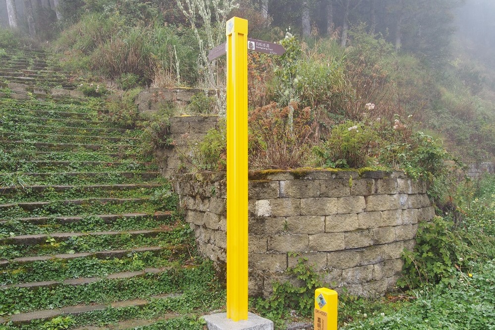
Xiangsong Trail
Source 臺東分署提供
With a total length of about 735 meters, the Xiangyang Trail rises in a zigzag shape and can connect to the Songtao Trail leading to Jiaming Lake; or connect to the Songjing Trail to the Tourist Service Center.
Trail
Songtao Trail
Source 臺東分署提供
The total length is 1,628 meters, and it is the highest point of the trail system in the area. The end of the trail is the entrance to Xiangyang Mountain and Jiaming Lake, and the main landscape is the Taiwan pine forest. You can often see black long-tailed pheasants appearing around you at 1.2-1.6 kilometers on the trail.
Trail
Songjing Trailer
Source 臺東分署提供
The trail is 1,231 meters long and starts from the visitor center, connecting to the Xiangsong and Songtao trails. There are two-leaf pine forests along the route and rest pavilions.
Trail
Xiangyang Trailer
Source 臺東分署提供
With a total length of 500 meters, this is the gentlest trail in the park and is the route chosen by most tourists. It is the only way to enter the amusement area and get to the visitor service center.

Trail
District trail guide map
The park is located in a geologically sensitive landslide area, so there are many landslides. Please do not enter the closed area and avoid traveling to the park before or after heavy rain for safety reasons.
Service Facilities
Map


Park Facilities
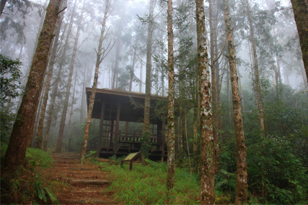
Siangyang Forest Recreation Area Visitor Center
Source 臺東分署
向陽森林遊樂區遊客中心為一綜合式建築,共分為展示室、多媒體室、休息室等,展示室提供向陽當地的動植物資源靜態介紹,另介紹布農族文化;多媒體室則提供定時之園區影片簡介,讓人可以在最短時間對向陽整體環境有一個概念;休息室提供遊客休憩與觀賞雲海、眺望山景的場所。
Nearby Attractions