.jpg)
.jpg)
.jpg)
.jpg)
.jpg)

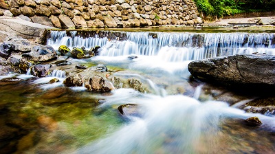
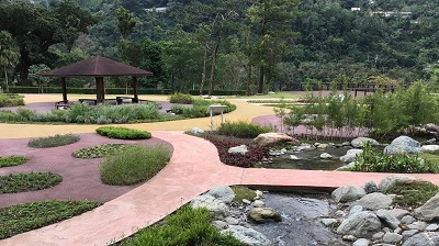
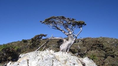
The entrance is located at about 23.6km on Dahan Forest Road, and the distance to the state boundary is about 2.7km, which is the Jinshuiying Trail (west section). In 2015, the Pingtung County Government announced it as a cultural landscape in accordance with the Cultural Heritage Preservation Act.
06/21 Sun.
Open
29°
26° / 31°
屏東縣 / 春日鄉
More
Weather Forecast
|
09.16
Thur.
|
09.17
Fri.
|
09.18
Sat.
|
09.19
Sun.
|
09.20
Mon.
|
09.21
Tue.
|
09.22
Wed.
|
|
|---|---|---|---|---|---|---|---|
| Temperature |
26 ° / 31 °
|
25 ° / 32 °
|
25 ° / 33 °
|
25 ° / 32 °
|
25 ° / 33 °
|
25 ° / 32 °
|
25 ° / 32 °
|
| Feel like | 30 ° / 38 ° | 29 ° / 39 ° | 29 ° / 38 ° | 29 ° / 39 ° | 29 ° / 40 ° | 29 ° / 39 ° | 29 ° / 39 ° |
|
Probability of Precipitation |
10 % | 10 % | 30 % | - | - | - | - |
| Relative Humidity | 94 % | 95 % | 90 % | 91 % | 89 % | 91 % | 92 % |
|
Wind speed Wind direction |
2
SW
|
2
SW
|
2
N
|
2
NW
|
2
N
|
-
N
|
2
NE
|
| UVI |
8
Very High
|
9
Very High
|
9
Very High
|
9
Very High
|
9
Very High
|
9
Very High
|
9
Very High
|
|
Sunrise Sunset |
|
|
|
|
|
|
|
Central Weather Bureau|Update Time:2021/09/16 11:17
Chunrih Township, Pingtung County
Jinshuiying Ancient Trail (West section)
Learn about the Trail
Trail difficulty level
| Hiking Level |
|
|
|
|
|
|
|
||||||||||||||||||||||||||||||||||||||||||
|---|---|---|---|---|---|---|---|---|---|---|---|---|---|---|---|---|---|---|---|---|---|---|---|---|---|---|---|---|---|---|---|---|---|---|---|---|---|---|---|---|---|---|---|---|---|---|---|---|---|
| Target | General Public | General Public | Those who have better physical energy | Beginner mountain climber with good physical energy and map literacy. | Open to those who have good physical strength, map reading skills, and wild survival skills. | Open to well-trained mountain climbers. | Open to well-trained mountain climbers. | ||||||||||||||||||||||||||||||||||||||||||
| Elevation | Gently sloping area | In recreational areas, close to settlements or about 1,000 meters above sea level. | In recreational areas, close to settlements or between 1,000~2,000 meters above sea level. | Remote areas or between 2,000 to 3,000 meters above sea level | Remote areas, wilderness, or between 2,000 to 3,000 meters above sea level | Remote areas, wilderness, or more than 3,000 meters above sea level | Remote areas, wilderness, or more than 3,000 meters above sea level | ||||||||||||||||||||||||||||||||||||||||||
| Required Time | It takes half to one day. | It takes half to one day. | It can be done within one day. | It takes one or more days. | Overnight preparation required. | It takes up to three days. | It takes up to three days. | ||||||||||||||||||||||||||||||||||||||||||
| Equipment | Light backpacking (water and small amount of food) | Light backpacking (water and small amount of food) | Light backpacking (water and proper amount of food) | Overnight preparation required. (e.g. drinking water, food, map, warm clothing, first-aid medicine, etc.) Application for entrance permission in advance is required if there is access control. | Comprehensive Mountaineering Gear Required. (e.g. food, drinking water, cooking utensils, map, warm clothing, flashlight, sleeping bag, tent, etc.) Application for entrance permission in advance is required if there is access control. | Comprehensive Mountaineering Gear Required. (e.g. food, drinking water, cooking utensils, map, warm clothing, flashlight, sleeping bag, tent, etc.) Application for entrance permission in advance is required if there is access control. | Comprehensive Mountaineering Gear Required. (e.g. food, drinking water, cooking utensils, map, warm clothing, flashlight, sleeping bag, tent, etc.) Application for entrance permission in advance is required if there is access control. | ||||||||||||||||||||||||||||||||||||||||||
| Description | Flat hiking trails. Relatively even slopes with comprehensive facilities and smooth road surface. Accessible for handicapped assistive devices or baby strollers. | An open hiking trail with easy access. Relatively even slopes with comprehensive facilities and smooth road surface. It takes half a day or less than one day to complete. | An open hiking trail with easy access. Somewhat steep slope with some difficult sections, but has comprehensive facilities and smooth road surface. It takes less than one day to complete. | A hiking trail locates at remote area or with part of the route is in area which requires entrance permission. Application in advance is required. Part of the route is in relatively bad condition with steeper slopes, but basic facilities are provided. It takes one day or between one to three days to complete. | A hiking trail locates at remote area or with part of the route is in area which requires entrance permission. It’s located in high-altitude areas (higher than 3000 meters above sea level). The trail is relatively primitive, with steeper slopes and unstable weather conditions. Part of the route may be dangerous or difficult for climbers. It takes two to three days to complete. Lead from professionals is recommended. | A hiking trail locates at area with inconvenient traffic, and mostly with routes in area which requires entrance permission. It’s located in high-altitude areas (higher than 3000 meters above sea level). The trail is located at primitive area, with bad condition, steeper slopes, and unstable weather conditions. Many parts of the route may be dangerous or difficult for climbers. It takes three or more days to complete. Lead from professionals is recommended. | 1. Level 3, 4 or 5 trails when snow or ice accumulating 2. Informal trails, without clear subgrades or paths, belong to special routes such as original mountain trails, ancient trail relics, prospecting, or technical climbing. |
Hiking Level
Target
General Public
Elevation
Gently sloping area
Required Time
It takes half to one day.
Equipment
Light backpacking (water and small amount of food)
Description
Flat hiking trails. Relatively even slopes with comprehensive facilities and smooth road surface. Accessible for handicapped assistive devices or baby strollers.
Hiking Level
Target
General Public
Elevation
In recreational areas, close to settlements or about 1,000 meters above sea level.
Required Time
It takes half to one day.
Equipment
Light backpacking (water and small amount of food)
Description
An open hiking trail with easy access. Relatively even slopes with comprehensive facilities and smooth road surface. It takes half a day or less than one day to complete.
Hiking Level
Target
Those who have better physical energy
Elevation
In recreational areas, close to settlements or between 1,000~2,000 meters above sea level.
Required Time
It can be done within one day.
Equipment
Light backpacking (water and proper amount of food)
Description
An open hiking trail with easy access. Somewhat steep slope with some difficult sections, but has comprehensive facilities and smooth road surface. It takes less than one day to complete.
Hiking Level
Target
Beginner mountain climber with good physical energy and map literacy.
Elevation
Remote areas or between 2,000 to 3,000 meters above sea level
Required Time
It takes one or more days.
Equipment
Overnight preparation required. (e.g. drinking water, food, map, warm clothing, first-aid medicine, etc.)
Application for entrance permission in advance is required if there is access control.
Description
A hiking trail locates at remote area or with part of the route is in area which requires entrance permission. Application in advance is required. Part of the route is in relatively bad condition with steeper slopes, but basic facilities are provided. It takes one day or between one to three days to complete.
Hiking Level
Target
Open to those who have good physical strength, map reading skills, and wild survival skills.
Elevation
Remote areas, wilderness, or between 2,000 to 3,000 meters above sea level
Required Time
Overnight preparation required.
Equipment
Comprehensive Mountaineering Gear Required. (e.g. food, drinking water, cooking utensils, map, warm clothing, flashlight, sleeping bag, tent, etc.)
Application for entrance permission in advance is required if there is access control.
Description
A hiking trail locates at remote area or with part of the route is in area which requires entrance permission. It’s located in high-altitude areas (higher than 3000 meters above sea level). The trail is relatively primitive, with steeper slopes and unstable weather conditions. Part of the route may be dangerous or difficult for climbers. It takes two to three days to complete. Lead from professionals is recommended.
Hiking Level
Target
Open to well-trained mountain climbers.
Elevation
Remote areas, wilderness, or more than 3,000 meters above sea level
Required Time
It takes up to three days.
Equipment
Comprehensive Mountaineering Gear Required. (e.g. food, drinking water, cooking utensils, map, warm clothing, flashlight, sleeping bag, tent, etc.)
Application for entrance permission in advance is required if there is access control.
Description
A hiking trail locates at area with inconvenient traffic, and mostly with routes in area which requires entrance permission. It’s located in high-altitude areas (higher than 3000 meters above sea level). The trail is located at primitive area, with bad condition, steeper slopes, and unstable weather conditions. Many parts of the route may be dangerous or difficult for climbers. It takes three or more days to complete. Lead from professionals is recommended.
Hiking Level
Target
Open to well-trained mountain climbers.
Elevation
Remote areas, wilderness, or more than 3,000 meters above sea level
Required Time
It takes up to three days.
Equipment
Comprehensive Mountaineering Gear Required. (e.g. food, drinking water, cooking utensils, map, warm clothing, flashlight, sleeping bag, tent, etc.)
Application for entrance permission in advance is required if there is access control.
Description
1. Level 3, 4 or 5 trails when snow or ice accumulating
2. Informal trails, without clear subgrades or paths, belong to special routes such as original mountain trails, ancient trail relics, prospecting, or technical climbing.
Reachable by Vehicle
O:Cars , X:Microbus、Coach Bus
Mountain system
-
Administer
Pingtung Forest Dist. Office
Elevation
1,150 ~ 1,400 m
Service Line
08-7882647
Altitude Difference
250 m
Huts
-
Length of the Trail
2.5 KM
Entry Permit
是
Trail type
Linear two-way
Via Nature Reserve
No
Road condition
-
Geologically Sensitive Area
No
Route planning
-
Debris Flow Torrents
No
Trail Track
Trail route
Trailhead / Trig
Mobile coverage
Observations (From iNaturalist)
Trailhead / Trig
Mobile coverage
Observations (From iNaturalist)
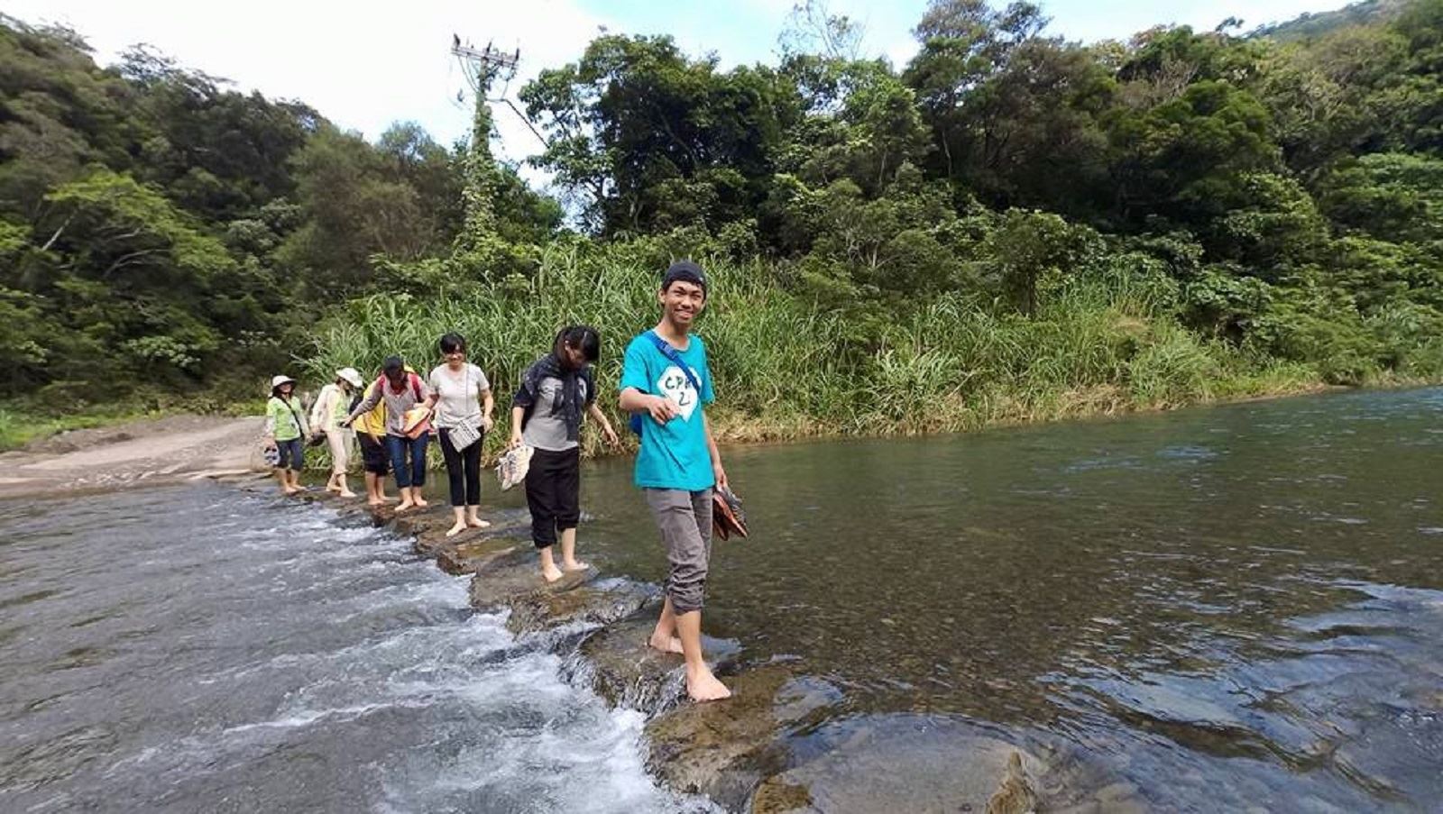
1. Half-day trip: Enter from about 23.6 kilometers on the Dahan Forest Road, walk to the state boundary (the border between Pingtung County and Taitung County) and turn back. You need to apply for entry to the mountain at the Pingtung County Government Police Station.
2. One-day trip: Enter from about 23.6 kilometers on the Dahan Forest Road, pass the state boundary and go to Jialuoban Village in Dawu Township, Taitung County. It is recommended to contact and prepare a shuttle vehicle in advance, otherwise you need to walk at least 4 kilometers. You need to apply for entry to the mountain at the Pingtung County Government Police Station and Taitung County Police Station.
2. One-day trip: Enter from about 23.6 kilometers on the Dahan Forest Road, pass the state boundary and go to Jialuoban Village in Dawu Township, Taitung County. It is recommended to contact and prepare a shuttle vehicle in advance, otherwise you need to walk at least 4 kilometers. You need to apply for entry to the mountain at the Pingtung County Government Police Station and Taitung County Police Station.
Reminders
Watch out for snakes and bees
There are bound to be snakes or bees in mountainous areas, so you should walk on the main trail. If you see a bee, avoid swatting it and pass by as quickly as possible to avoid being stung.
Bicycles are banned along the Jinshuiying Ancient Trail
To prevent bicycles from entering the Jinshuiying Ancient Trail and endangering the safety of other people, bicycles are prohibited along the entire trail. Violators may be fined by the police in accordance with the Road Traffic Management Penalty Regulations.
The Jinshuiying Ancient Trail is a long way to go, please consider your physical fitness, entry time and prepare relevant equipment
Since the Jinshuiying Ancient Trail is over 16 kilometers long, please consider your physical fitness, the time of entry and the walking time. It is also recommended to prepare relevant equipment (such as flashlights, GPS, satellite phones, warm clothes, etc.) to avoid danger in the dark. The average walking time is 6 to 8 hours.
Personal Positioning Radio Beacon (PLB) must complete personal information registration and identity identification before it can play the emergency rescue function. PLB holders can apply for registration to the Bureau of Maritime and Ports of the Ministry of Transportation and Communications from June 30, 2016. The relevant application information registration form is placed on the official website of the Bureau of Maritime and Ports of the Ministry of Transportation and Communications: Global Information Network of the Bureau of Maritime and Ports of the Ministry of Transportation and Communications/Download Area/Air Safety Category/Personal Positioning Radio Beacon (PLB) Holder Information Registration Form (Chinese Version) or (English Version). The Southern Navigation Center of the Bureau of Maritime and Ports of the Ministry of Transportation and Communications is located at No. 2, Gushan 1st Road, Gushan District, Kaohsiung City 80444. The switchboard number is 07-2620758.
Personal Positioning Radio Beacon (PLB) must complete personal information registration and identity identification before it can play the emergency rescue function. PLB holders can apply for registration to the Bureau of Maritime and Ports of the Ministry of Transportation and Communications from June 30, 2016. The relevant application information registration form is placed on the official website of the Bureau of Maritime and Ports of the Ministry of Transportation and Communications: Global Information Network of the Bureau of Maritime and Ports of the Ministry of Transportation and Communications/Download Area/Air Safety Category/Personal Positioning Radio Beacon (PLB) Holder Information Registration Form (Chinese Version) or (English Version). The Southern Navigation Center of the Bureau of Maritime and Ports of the Ministry of Transportation and Communications is located at No. 2, Gushan 1st Road, Gushan District, Kaohsiung City 80444. The switchboard number is 07-2620758.
Coordinates of the location where the mobile phone can communicate
120.7637度,22.4087度
Recommended Equipment
The Jinshuiying Trails Suggested Equipment List for One-Day Hiking Trails
Mountain Encyclopedia
Please click below to view information
Regulations for bringing pets
When traveling with pets, please tie them up properly or place them in cages, bags, or carts to prevent them from chasing or scaring wild animals. Please clean up their excrement and avoid contact with wild animals.
Travel Guide

Travel Guide
Nearby Attractions
Nature Trail Passport
If you are interested in learning more about relevant environmental resources information, you can download it from the following link.
More
Nearby Attractions