The Jinshuiying National Trail starts from Shuidiliao in Fangliao Township, Pingtung County on the west side and ends at the Jialuo Settlement in Dawu Township, Taitung County on the east side. Among all the ancient trails that cross the Central Mountain Range, the mountain-crossing point of this trail is the lowest and the most frequently used. It is also the oldest trail in service. Many ruins can still be seen along the way. The biological diversity is very high and the number of rare plants is among the largest in Taiwan. Ferns and Orchids are particularly abundant. It is a trail with cultural and historical traces and unusual natural ecology and landscape.
06/21 Sun.
Open
29°
26° / 31°
臺東縣 / 達仁鄉
More
Weather Forecast
|
09.16
Thur.
|
09.17
Fri.
|
09.18
Sat.
|
09.19
Sun.
|
09.20
Mon.
|
09.21
Tue.
|
09.22
Wed.
|
|
|---|---|---|---|---|---|---|---|
| Temperature |
26 ° / 31 °
|
25 ° / 32 °
|
25 ° / 31 °
|
25 ° / 31 °
|
25 ° / 31 °
|
25 ° / 31 °
|
25 ° / 31 °
|
| Feel like | 31 ° / 37 ° | 29 ° / 38 ° | 28 ° / 35 ° | 28 ° / 36 ° | 29 ° / 36 ° | 29 ° / 36 ° | 29 ° / 35 ° |
|
Probability of Precipitation |
40 % | 20 % | 20 % | - | - | - | - |
| Relative Humidity | 89 % | 90 % | 84 % | 85 % | 83 % | 79 % | 84 % |
|
Wind speed Wind direction |
2
SW
|
3
S
|
3
NE
|
3
NE
|
3
N
|
3
N
|
3
NE
|
| UVI |
8
Very High
|
9
Very High
|
9
Very High
|
9
Very High
|
9
Very High
|
9
Very High
|
9
Very High
|
|
Sunrise Sunset |
|
|
|
|
|
|
|
Central Weather Bureau|Update Time:2021/09/16 11:17
Daren Township, Taitung County
Jinshuiying National Trail (East Section)
Learn about the Trail
Trail difficulty level
| Hiking Level |
|
|
|
|
|
|
|
||||||||||||||||||||||||||||||||||||||||||
|---|---|---|---|---|---|---|---|---|---|---|---|---|---|---|---|---|---|---|---|---|---|---|---|---|---|---|---|---|---|---|---|---|---|---|---|---|---|---|---|---|---|---|---|---|---|---|---|---|---|
| Target | General Public | General Public | Those who have better physical energy | Beginner mountain climber with good physical energy and map literacy. | Open to those who have good physical strength, map reading skills, and wild survival skills. | Open to well-trained mountain climbers. | Open to well-trained mountain climbers. | ||||||||||||||||||||||||||||||||||||||||||
| Elevation | Gently sloping area | In recreational areas, close to settlements or about 1,000 meters above sea level. | In recreational areas, close to settlements or between 1,000~2,000 meters above sea level. | Remote areas or between 2,000 to 3,000 meters above sea level | Remote areas, wilderness, or between 2,000 to 3,000 meters above sea level | Remote areas, wilderness, or more than 3,000 meters above sea level | Remote areas, wilderness, or more than 3,000 meters above sea level | ||||||||||||||||||||||||||||||||||||||||||
| Required Time | It takes half to one day. | It takes half to one day. | It can be done within one day. | It takes one or more days. | Overnight preparation required. | It takes up to three days. | It takes up to three days. | ||||||||||||||||||||||||||||||||||||||||||
| Equipment | Light backpacking (water and small amount of food) | Light backpacking (water and small amount of food) | Light backpacking (water and proper amount of food) | Overnight preparation required. (e.g. drinking water, food, map, warm clothing, first-aid medicine, etc.) Application for entrance permission in advance is required if there is access control. | Comprehensive Mountaineering Gear Required. (e.g. food, drinking water, cooking utensils, map, warm clothing, flashlight, sleeping bag, tent, etc.) Application for entrance permission in advance is required if there is access control. | Comprehensive Mountaineering Gear Required. (e.g. food, drinking water, cooking utensils, map, warm clothing, flashlight, sleeping bag, tent, etc.) Application for entrance permission in advance is required if there is access control. | Comprehensive Mountaineering Gear Required. (e.g. food, drinking water, cooking utensils, map, warm clothing, flashlight, sleeping bag, tent, etc.) Application for entrance permission in advance is required if there is access control. | ||||||||||||||||||||||||||||||||||||||||||
| Description | Flat hiking trails. Relatively even slopes with comprehensive facilities and smooth road surface. Accessible for handicapped assistive devices or baby strollers. | An open hiking trail with easy access. Relatively even slopes with comprehensive facilities and smooth road surface. It takes half a day or less than one day to complete. | An open hiking trail with easy access. Somewhat steep slope with some difficult sections, but has comprehensive facilities and smooth road surface. It takes less than one day to complete. | A hiking trail locates at remote area or with part of the route is in area which requires entrance permission. Application in advance is required. Part of the route is in relatively bad condition with steeper slopes, but basic facilities are provided. It takes one day or between one to three days to complete. | A hiking trail locates at remote area or with part of the route is in area which requires entrance permission. It’s located in high-altitude areas (higher than 3000 meters above sea level). The trail is relatively primitive, with steeper slopes and unstable weather conditions. Part of the route may be dangerous or difficult for climbers. It takes two to three days to complete. Lead from professionals is recommended. | A hiking trail locates at area with inconvenient traffic, and mostly with routes in area which requires entrance permission. It’s located in high-altitude areas (higher than 3000 meters above sea level). The trail is located at primitive area, with bad condition, steeper slopes, and unstable weather conditions. Many parts of the route may be dangerous or difficult for climbers. It takes three or more days to complete. Lead from professionals is recommended. | 1. Level 3, 4 or 5 trails when snow or ice accumulating 2. Informal trails, without clear subgrades or paths, belong to special routes such as original mountain trails, ancient trail relics, prospecting, or technical climbing. |
Hiking Level
Target
General Public
Elevation
Gently sloping area
Required Time
It takes half to one day.
Equipment
Light backpacking (water and small amount of food)
Description
Flat hiking trails. Relatively even slopes with comprehensive facilities and smooth road surface. Accessible for handicapped assistive devices or baby strollers.
Hiking Level
Target
General Public
Elevation
In recreational areas, close to settlements or about 1,000 meters above sea level.
Required Time
It takes half to one day.
Equipment
Light backpacking (water and small amount of food)
Description
An open hiking trail with easy access. Relatively even slopes with comprehensive facilities and smooth road surface. It takes half a day or less than one day to complete.
Hiking Level
Target
Those who have better physical energy
Elevation
In recreational areas, close to settlements or between 1,000~2,000 meters above sea level.
Required Time
It can be done within one day.
Equipment
Light backpacking (water and proper amount of food)
Description
An open hiking trail with easy access. Somewhat steep slope with some difficult sections, but has comprehensive facilities and smooth road surface. It takes less than one day to complete.
Hiking Level
Target
Beginner mountain climber with good physical energy and map literacy.
Elevation
Remote areas or between 2,000 to 3,000 meters above sea level
Required Time
It takes one or more days.
Equipment
Overnight preparation required. (e.g. drinking water, food, map, warm clothing, first-aid medicine, etc.)
Application for entrance permission in advance is required if there is access control.
Description
A hiking trail locates at remote area or with part of the route is in area which requires entrance permission. Application in advance is required. Part of the route is in relatively bad condition with steeper slopes, but basic facilities are provided. It takes one day or between one to three days to complete.
Hiking Level
Target
Open to those who have good physical strength, map reading skills, and wild survival skills.
Elevation
Remote areas, wilderness, or between 2,000 to 3,000 meters above sea level
Required Time
Overnight preparation required.
Equipment
Comprehensive Mountaineering Gear Required. (e.g. food, drinking water, cooking utensils, map, warm clothing, flashlight, sleeping bag, tent, etc.)
Application for entrance permission in advance is required if there is access control.
Description
A hiking trail locates at remote area or with part of the route is in area which requires entrance permission. It’s located in high-altitude areas (higher than 3000 meters above sea level). The trail is relatively primitive, with steeper slopes and unstable weather conditions. Part of the route may be dangerous or difficult for climbers. It takes two to three days to complete. Lead from professionals is recommended.
Hiking Level
Target
Open to well-trained mountain climbers.
Elevation
Remote areas, wilderness, or more than 3,000 meters above sea level
Required Time
It takes up to three days.
Equipment
Comprehensive Mountaineering Gear Required. (e.g. food, drinking water, cooking utensils, map, warm clothing, flashlight, sleeping bag, tent, etc.)
Application for entrance permission in advance is required if there is access control.
Description
A hiking trail locates at area with inconvenient traffic, and mostly with routes in area which requires entrance permission. It’s located in high-altitude areas (higher than 3000 meters above sea level). The trail is located at primitive area, with bad condition, steeper slopes, and unstable weather conditions. Many parts of the route may be dangerous or difficult for climbers. It takes three or more days to complete. Lead from professionals is recommended.
Hiking Level
Target
Open to well-trained mountain climbers.
Elevation
Remote areas, wilderness, or more than 3,000 meters above sea level
Required Time
It takes up to three days.
Equipment
Comprehensive Mountaineering Gear Required. (e.g. food, drinking water, cooking utensils, map, warm clothing, flashlight, sleeping bag, tent, etc.)
Application for entrance permission in advance is required if there is access control.
Description
1. Level 3, 4 or 5 trails when snow or ice accumulating
2. Informal trails, without clear subgrades or paths, belong to special routes such as original mountain trails, ancient trail relics, prospecting, or technical climbing.
Reachable by Vehicle
O:Cars , X:Microbus、Coach Bus
Mountain system
Tahan Mountain
Administer
Taitung Forest Dist. Office
Elevation
122 ~ 1,450 m
Service Line
+886 893241214
Altitude Difference
1,328 m
Huts
-
Length of the Trail
13.2 KM
Entry Permit
是
Trail type
Linear two-way
Via Nature Reserve
No
Road condition
Soil trail
Geologically Sensitive Area
Yes
Route planning
1 day
Debris Flow Torrents
No
Trail Track
Trail route
Trailhead / Trig
Mobile coverage
Observations (From iNaturalist)
Trailhead / Trig
Mobile coverage
Observations (From iNaturalist)
Reminders
Regulations for carrying pets
When bringing pets, please tie them properly or place them in a cage, bag, or cart to prevent them from chasing or scaring wild animals. Please clean up their excrement and avoid contact with wild animals.
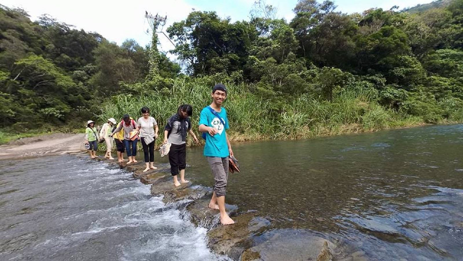
Jialuoban River is not suitable for traffic
Due to the rising water level of the Jialuoban River, it is dangerous to travel. Please take the alternative detour route (on-site signs) for safety.
Application for mountain entry control instructions
It is a mountain restricted area. If you want to enter the trail, you are advised to go to the Taiwan Mountaineering Application One-Stop Service Network one week in advance to apply for mountain entry in Pingtung County and Taitung County. Or you can go to the Guichong Police Station to apply for a mountain entry permit before entering the trail.
Recommended equipment
Recommended equipment list for the East Section of the Jinshuiying National Trail - One-day hiking trail
Mountain Encyclopedia
Please click below to view information
Travel Guide

Travel Guide
Featured Landscape

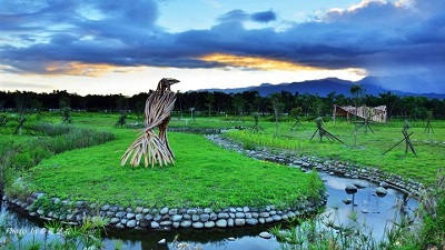
Ancient Road Relics and the Smoky Past
Source|臺東分署
There are still many relics in the front section of the trail: the leading stone tablet of Shuidiliao, which was erected by the Japanese in 1901 and where travelers to Dawu would come to worship; the Shengji Pavilion, which was built by Qing soldiers stationed in Shitouying to teach the indigenous people to respect writing; and the original site of Kantouying in the Qing Dynasty and the Japanese police station next to Tiantai Palace. At 7.4K, 14K, and 20.1K of the Dahanlin Road, there are the ruins of Guihua Gate, Liuyi Society, Dashuqian Camp, and Dashulin Garrison respectively. After entering the ancient road, there are ruins of "Jinshuiying Garrison", "Chushuipo Garrison", "Chushuipo Shrine", "Charcoal Kiln", "Xinguzilun Garrison", "Qing Dynasty Xidi Camp Site", "Guzilun Suspension Bridge" and so on along the way.

Highly biodiverse trails
Source|臺東分署
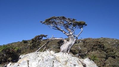
The trail runs along the belly of Mount Tahan and Mount Kuzilun, and is influenced by the northeast and southwest monsoons and the geographical environment where the tropics and subtropics meet, and has extremely high biological diversity. The forests along the way are lush and green, with more than 700 plant species, including Taiwan's unique or rare species such as the Taiwan Metasequoia, Dawu Rhododendron, Giant Leaf Polygala, Willow-leaved Lithops, Wave-margined Quercus, and Jinshuiying Lithops. At an altitude of about 1,300 meters, there are a large number of ancient relict plants, the Kunlan tree, and dried and fallen fruit bunches can often be seen on the trail.

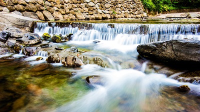
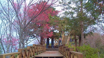
Crystal clear green treasure box
Source|臺東分署
The trail spans low and medium altitude areas, and there are flowers and leaves blooming in all seasons, especially in spring. From high to low, there are the translucent purple-pink curved-stem indigo, the rare peach-red giant-leafed polygala, the light purple butterfly-like Taiwan violet, the Taiwan sesame flower that is sometimes light red and sometimes purple-red, the red nan with tender new leaves and fine green flowers, the pure white and quiet Alishan root orchid, the Kunlan tree with leaves arranged in whorls, the white and purple wild peony, the small plant and beautiful flowers of the fleshy wild peony, and the white and fragrant mountain peony, etc. The colorful flowers and leaves decorate the ancient trail with bright and elegant beauty. Among them, the giant-leafed Polygala is a rare plant unique to Taiwan. It blooms along the road in spring and is a beautiful flower that cannot be missed.
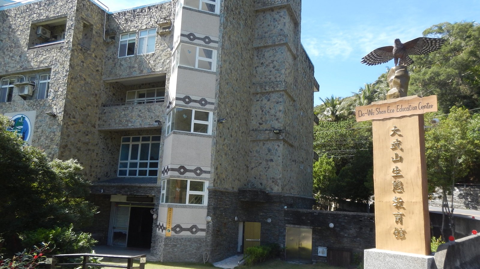
Nearby Attractions