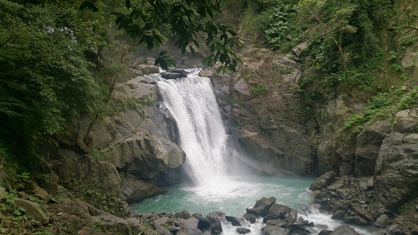
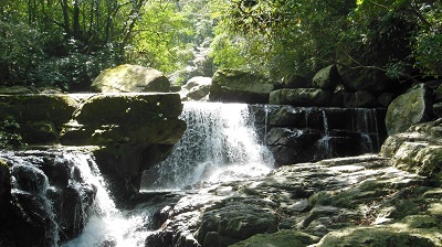
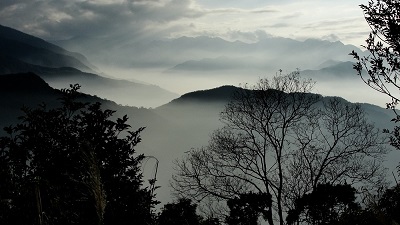
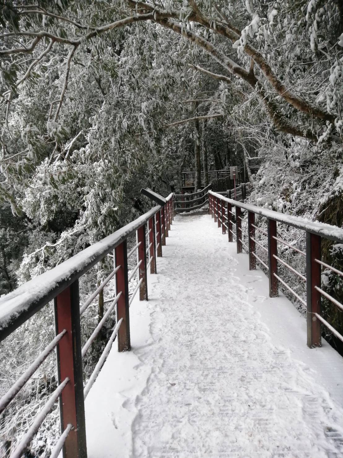
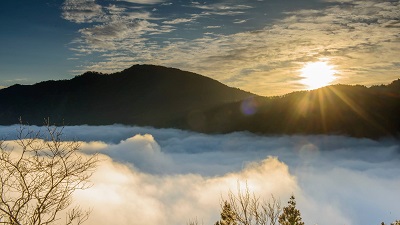
Located behind Datong (big bucket) Mountain, it is called Tonghou (behind the bucket). In the early days, it was the mountain path the Atayal people would take to go hunting and also one of the three major trails the Atayal people in Wulai would take to travel between mountains. The Tonghou Creek meanders in the mountains and forms rapid currents, short waterfalls, lakes and shoals. The views of the surrounding areas are all different and make the area a popular spot that draws visitors to play in the water or fish in summer. Around Anbu, right on the border of Taipei and Yilan and the highest point of the mountain-crossing trail, huge patches of miscanthus swaying in the northeasterly monsoon wind in autumn is a wonderful sight.
06/21 Sun.
Open
27°
24° / 30°
新北市 / 烏來區
More
Weather Forecast
|
09.16
Thur.
|
09.17
Fri.
|
09.18
Sat.
|
09.19
Sun.
|
09.20
Mon.
|
09.21
Tue.
|
09.22
Wed.
|
|
|---|---|---|---|---|---|---|---|
| Temperature |
24 ° / 30 °
|
22 ° / 30 °
|
22 ° / 30 °
|
23 ° / 32 °
|
23 ° / 32 °
|
23 ° / 31 °
|
23 ° / 31 °
|
| Feel like | 28 ° / 36 ° | 26 ° / 37 ° | 25 ° / 36 ° | 26 ° / 36 ° | 26 ° / 37 ° | 26 ° / 35 ° | 26 ° / 36 ° |
|
Probability of Precipitation |
60 % | 70 % | 90 % | - | - | - | - |
| Relative Humidity | 88 % | 91 % | 86 % | 81 % | 82 % | 81 % | 83 % |
|
Wind speed Wind direction |
2
SW
|
2
W
|
2
SW
|
2
S
|
2
E
|
2
SW
|
2
SW
|
| UVI |
8
Very High
|
8
Very High
|
9
Very High
|
10
Very High
|
9
Very High
|
9
Very High
|
10
Very High
|
|
Sunrise Sunset |
|
|
|
|
|
|
|
Central Weather Bureau|Update Time:2021/09/16 11:17
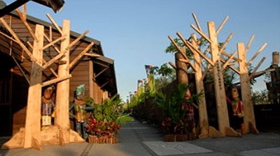
Wulai District, New Taipei City
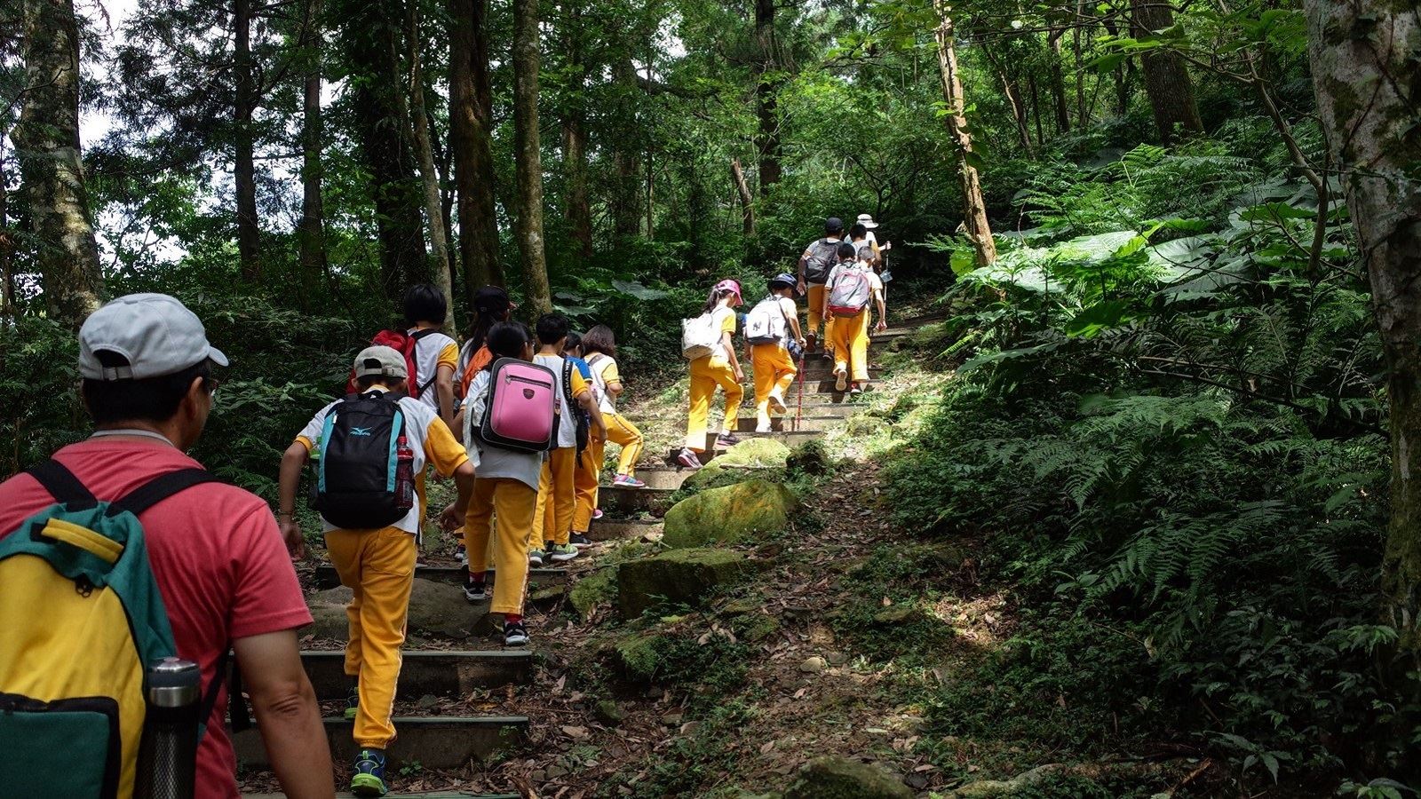
Tonghouyueling Trail
Learn about the Trail
Application
Transportation
From Wulai
Get off at the Xindian Interchange on National Highway 3 and follow the signs to Xinwu Road towards Wulai. Turn left at Wulai Bridge and head towards Xiaoyi Village to Tonghou Forest Road. Tonghou Forest Road is subject to vehicle control in accordance with the principle of "control vehicles but not people". Except for the following vehicles, only pedestrians or non-powered vehicles (bicycles, electric-assisted bicycles) are allowed to enter. Other vehicles are not allowed to enter.
(1) Those who must pass for official business and hold certificates.
(2) Vehicles performing disaster relief tasks.
(3) Local residents who must pass for residence, life or work and hold certificates.
(4) In order to provide mountaineering needs such as Tonghou Crossing Trail, taxis or multi-taxi taxis in this area are not allowed to stop for connection needs.
Xindian Bus (Wulai Station)
Wulai Station→Xiaoyi Community→Tonghou Forest Trail→Tonghou Mountain Trail
Trail difficulty level
| Hiking Level |
|
|
|
|
|
|
|
||||||||||||||||||||||||||||||||||||||||||
|---|---|---|---|---|---|---|---|---|---|---|---|---|---|---|---|---|---|---|---|---|---|---|---|---|---|---|---|---|---|---|---|---|---|---|---|---|---|---|---|---|---|---|---|---|---|---|---|---|---|
| Target | General Public | General Public | Those who have better physical energy | Beginner mountain climber with good physical energy and map literacy. | Open to those who have good physical strength, map reading skills, and wild survival skills. | Open to well-trained mountain climbers. | Open to well-trained mountain climbers. | ||||||||||||||||||||||||||||||||||||||||||
| Elevation | Gently sloping area | In recreational areas, close to settlements or about 1,000 meters above sea level. | In recreational areas, close to settlements or between 1,000~2,000 meters above sea level. | Remote areas or between 2,000 to 3,000 meters above sea level | Remote areas, wilderness, or between 2,000 to 3,000 meters above sea level | Remote areas, wilderness, or more than 3,000 meters above sea level | Remote areas, wilderness, or more than 3,000 meters above sea level | ||||||||||||||||||||||||||||||||||||||||||
| Required Time | It takes half to one day. | It takes half to one day. | It can be done within one day. | It takes one or more days. | Overnight preparation required. | It takes up to three days. | It takes up to three days. | ||||||||||||||||||||||||||||||||||||||||||
| Equipment | Light backpacking (water and small amount of food) | Light backpacking (water and small amount of food) | Light backpacking (water and proper amount of food) | Overnight preparation required. (e.g. drinking water, food, map, warm clothing, first-aid medicine, etc.) Application for entrance permission in advance is required if there is access control. | Comprehensive Mountaineering Gear Required. (e.g. food, drinking water, cooking utensils, map, warm clothing, flashlight, sleeping bag, tent, etc.) Application for entrance permission in advance is required if there is access control. | Comprehensive Mountaineering Gear Required. (e.g. food, drinking water, cooking utensils, map, warm clothing, flashlight, sleeping bag, tent, etc.) Application for entrance permission in advance is required if there is access control. | Comprehensive Mountaineering Gear Required. (e.g. food, drinking water, cooking utensils, map, warm clothing, flashlight, sleeping bag, tent, etc.) Application for entrance permission in advance is required if there is access control. | ||||||||||||||||||||||||||||||||||||||||||
| Description | Flat hiking trails. Relatively even slopes with comprehensive facilities and smooth road surface. Accessible for handicapped assistive devices or baby strollers. | An open hiking trail with easy access. Relatively even slopes with comprehensive facilities and smooth road surface. It takes half a day or less than one day to complete. | An open hiking trail with easy access. Somewhat steep slope with some difficult sections, but has comprehensive facilities and smooth road surface. It takes less than one day to complete. | A hiking trail locates at remote area or with part of the route is in area which requires entrance permission. Application in advance is required. Part of the route is in relatively bad condition with steeper slopes, but basic facilities are provided. It takes one day or between one to three days to complete. | A hiking trail locates at remote area or with part of the route is in area which requires entrance permission. It’s located in high-altitude areas (higher than 3000 meters above sea level). The trail is relatively primitive, with steeper slopes and unstable weather conditions. Part of the route may be dangerous or difficult for climbers. It takes two to three days to complete. Lead from professionals is recommended. | A hiking trail locates at area with inconvenient traffic, and mostly with routes in area which requires entrance permission. It’s located in high-altitude areas (higher than 3000 meters above sea level). The trail is located at primitive area, with bad condition, steeper slopes, and unstable weather conditions. Many parts of the route may be dangerous or difficult for climbers. It takes three or more days to complete. Lead from professionals is recommended. | 1. Level 3, 4 or 5 trails when snow or ice accumulating 2. Informal trails, without clear subgrades or paths, belong to special routes such as original mountain trails, ancient trail relics, prospecting, or technical climbing. |
Hiking Level
Target
General Public
Elevation
Gently sloping area
Required Time
It takes half to one day.
Equipment
Light backpacking (water and small amount of food)
Description
Flat hiking trails. Relatively even slopes with comprehensive facilities and smooth road surface. Accessible for handicapped assistive devices or baby strollers.
Hiking Level
Target
General Public
Elevation
In recreational areas, close to settlements or about 1,000 meters above sea level.
Required Time
It takes half to one day.
Equipment
Light backpacking (water and small amount of food)
Description
An open hiking trail with easy access. Relatively even slopes with comprehensive facilities and smooth road surface. It takes half a day or less than one day to complete.
Hiking Level
Target
Those who have better physical energy
Elevation
In recreational areas, close to settlements or between 1,000~2,000 meters above sea level.
Required Time
It can be done within one day.
Equipment
Light backpacking (water and proper amount of food)
Description
An open hiking trail with easy access. Somewhat steep slope with some difficult sections, but has comprehensive facilities and smooth road surface. It takes less than one day to complete.
Hiking Level
Target
Beginner mountain climber with good physical energy and map literacy.
Elevation
Remote areas or between 2,000 to 3,000 meters above sea level
Required Time
It takes one or more days.
Equipment
Overnight preparation required. (e.g. drinking water, food, map, warm clothing, first-aid medicine, etc.)
Application for entrance permission in advance is required if there is access control.
Description
A hiking trail locates at remote area or with part of the route is in area which requires entrance permission. Application in advance is required. Part of the route is in relatively bad condition with steeper slopes, but basic facilities are provided. It takes one day or between one to three days to complete.
Hiking Level
Target
Open to those who have good physical strength, map reading skills, and wild survival skills.
Elevation
Remote areas, wilderness, or between 2,000 to 3,000 meters above sea level
Required Time
Overnight preparation required.
Equipment
Comprehensive Mountaineering Gear Required. (e.g. food, drinking water, cooking utensils, map, warm clothing, flashlight, sleeping bag, tent, etc.)
Application for entrance permission in advance is required if there is access control.
Description
A hiking trail locates at remote area or with part of the route is in area which requires entrance permission. It’s located in high-altitude areas (higher than 3000 meters above sea level). The trail is relatively primitive, with steeper slopes and unstable weather conditions. Part of the route may be dangerous or difficult for climbers. It takes two to three days to complete. Lead from professionals is recommended.
Hiking Level
Target
Open to well-trained mountain climbers.
Elevation
Remote areas, wilderness, or more than 3,000 meters above sea level
Required Time
It takes up to three days.
Equipment
Comprehensive Mountaineering Gear Required. (e.g. food, drinking water, cooking utensils, map, warm clothing, flashlight, sleeping bag, tent, etc.)
Application for entrance permission in advance is required if there is access control.
Description
A hiking trail locates at area with inconvenient traffic, and mostly with routes in area which requires entrance permission. It’s located in high-altitude areas (higher than 3000 meters above sea level). The trail is located at primitive area, with bad condition, steeper slopes, and unstable weather conditions. Many parts of the route may be dangerous or difficult for climbers. It takes three or more days to complete. Lead from professionals is recommended.
Hiking Level
Target
Open to well-trained mountain climbers.
Elevation
Remote areas, wilderness, or more than 3,000 meters above sea level
Required Time
It takes up to three days.
Equipment
Comprehensive Mountaineering Gear Required. (e.g. food, drinking water, cooking utensils, map, warm clothing, flashlight, sleeping bag, tent, etc.)
Application for entrance permission in advance is required if there is access control.
Description
1. Level 3, 4 or 5 trails when snow or ice accumulating
2. Informal trails, without clear subgrades or paths, belong to special routes such as original mountain trails, ancient trail relics, prospecting, or technical climbing.
Reachable by Vehicle
X:Cars、Microbus、Coach Bus
Mountain system
Beitao Mountain Area
Administer
Hsinchu Forest Dist. Office
Elevation
450 ~ 730 m
Service Line
+886 35224163 #241
Altitude Difference
280 m
Huts
-
Length of the Trail
7 KM
Entry Permit
No
Trail type
Linear two-way
Via Nature Reserve
No
Service Line
Primitive mountain trail
Geologically Sensitive Area
Yes
Route planning
1 day
Debris Flow Torrents
No
Trail Track
Trail route
Trailhead / Trig
Mobile coverage
Observations (From iNaturalist)
Trailhead / Trig
Mobile coverage
Observations (From iNaturalist)
Reminders
Recommended Equipment
Tonghou Mountain Crossing Trail_Single-day Mountaineering Trail Recommended Equipment List
Mountain Encyclopedia
Please click below to view information
Vehicle control on forest roads
The Tonghou Forest Trail is required for forestry management. In order to implement forest protection, maintain the ecological environment and ensure smooth movement of the forest trail, the principle of "controlling vehicles but not people" is followed to control the entry of powered vehicles. Except for the following vehicles, only walking or non-powered vehicles (bicycles, electric-assisted bicycles) are allowed to enter. Other vehicles are not allowed to enter. Pedestrians should pay attention to safety when walking and avoid going there during rainy days to maintain their own safety. In order to reduce the time required to walk the 12-kilometer forest trail for people who take the Tonghou Cross-Hill Trail, the Hsinchu Branch Office, after considering the principle of ecological protection priority and based on total quantity control and connection needs, is open to taxis (including multi-purpose taxis) in this area. After applying for permission, they can carry people who want to hike the Tonghou Cross-Hill Trail into the Tonghou Forest Trail to reach the trailhead.
Travel Guide

Travel Guide
Nearby Attractions
Jiaoxi
Because Jiaoxi is located in a volcanic belt, it has formed a variety of landscapes such as special hot springs, waterfalls, lakes and mountain views. Jiaoxi, with fertile land and abundant water resources, is not only suitable for agricultural development, but also a popular tourist attraction, especially Jiaoxi Hot Springs.
More
Travel Advice
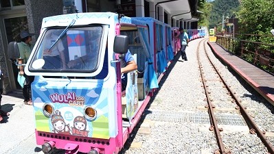
You can turn back along the road, or walk on a single line, and arrange a vehicle to pick you up. You can also arrange a 1-2 day trip with Wulai Scenic Area or Jiaoxi
Nearby Attractions