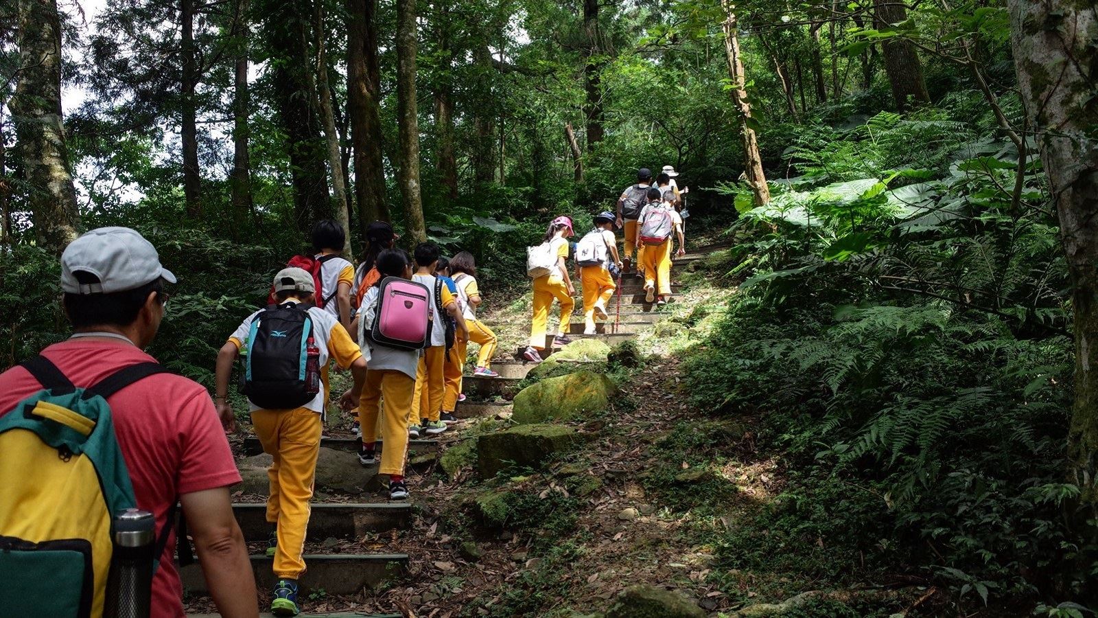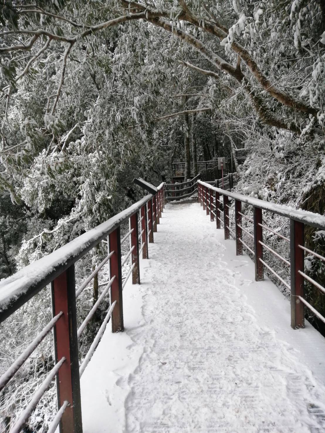


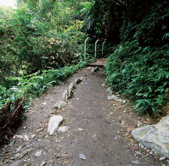
The Linmei Shipan Trail lies in a low-altitude subtropical ravine. There are waterfalls and sheltering forests. The trail is flat and smooth all the way and the cool and comfortable temperature is suitable for family outings. It used to be an important path for the locals to fetch water for farming and daily life uses in the early days. Historical traces of the trailblazing efforts of the pioneers can be seen. They bring back lots of childhood memories for the people in the village.
06/21 Sun.
Open
29°
26° / 32°
宜蘭縣 / 礁溪鄉
More
Weather Forecast
|
09.16
Thur.
|
09.17
Fri.
|
09.18
Sat.
|
09.19
Sun.
|
09.20
Mon.
|
09.21
Tue.
|
09.22
Wed.
|
|
|---|---|---|---|---|---|---|---|
| Temperature |
26 ° / 32 °
|
25 ° / 32 °
|
25 ° / 32 °
|
25 ° / 32 °
|
25 ° / 33 °
|
25 ° / 32 °
|
25 ° / 32 °
|
| Feel like | 31 ° / 37 ° | 29 ° / 38 ° | 29 ° / 37 ° | 29 ° / 38 ° | 29 ° / 39 ° | 28 ° / 37 ° | 29 ° / 37 ° |
|
Probability of Precipitation |
50 % | 60 % | 40 % | - | - | - | - |
| Relative Humidity | 84 % | 85 % | 84 % | 87 % | 83 % | 80 % | 85 % |
|
Wind speed Wind direction |
2
S
|
2
E
|
2
SW
|
2
SW
|
2
W
|
2
NW
|
2
W
|
| UVI |
8
Very High
|
8
Very High
|
9
Very High
|
9
Very High
|
10
Very High
|
10
Very High
|
9
Very High
|
|
Sunrise Sunset |
|
|
|
|
|
|
|
Central Weather Bureau|Update Time:2021/09/16 11:17
Jiaosi Township, Yilan County
Linmei Shihpan Trail
Learn about the Trail
Application
Transportation
Provincial Highway 9
Take Provincial highway no.9 to Jiaoxi→Turn the path toward Linwei→pass Dafeng bridge and head to campus of Fo Guang University→enter at the trail to the right of industrial road, and head to Linmei Shipan Trail
By train
Take Taxi from JiaoXi Train Station
Trail difficulty level
| Hiking Level |
|
|
|
|
|
|
|
||||||||||||||||||||||||||||||||||||||||||
|---|---|---|---|---|---|---|---|---|---|---|---|---|---|---|---|---|---|---|---|---|---|---|---|---|---|---|---|---|---|---|---|---|---|---|---|---|---|---|---|---|---|---|---|---|---|---|---|---|---|
| Target | General Public | General Public | Those who have better physical energy | Beginner mountain climber with good physical energy and map literacy. | Open to those who have good physical strength, map reading skills, and wild survival skills. | Open to well-trained mountain climbers. | Open to well-trained mountain climbers. | ||||||||||||||||||||||||||||||||||||||||||
| Elevation | Gently sloping area | In recreational areas, close to settlements or about 1,000 meters above sea level. | In recreational areas, close to settlements or between 1,000~2,000 meters above sea level. | Remote areas or between 2,000 to 3,000 meters above sea level | Remote areas, wilderness, or between 2,000 to 3,000 meters above sea level | Remote areas, wilderness, or more than 3,000 meters above sea level | Remote areas, wilderness, or more than 3,000 meters above sea level | ||||||||||||||||||||||||||||||||||||||||||
| Required Time | It takes half to one day. | It takes half to one day. | It can be done within one day. | It takes one or more days. | Overnight preparation required. | It takes up to three days. | It takes up to three days. | ||||||||||||||||||||||||||||||||||||||||||
| Equipment | Light backpacking (water and small amount of food) | Light backpacking (water and small amount of food) | Light backpacking (water and proper amount of food) | Overnight preparation required. (e.g. drinking water, food, map, warm clothing, first-aid medicine, etc.) Application for entrance permission in advance is required if there is access control. | Comprehensive Mountaineering Gear Required. (e.g. food, drinking water, cooking utensils, map, warm clothing, flashlight, sleeping bag, tent, etc.) Application for entrance permission in advance is required if there is access control. | Comprehensive Mountaineering Gear Required. (e.g. food, drinking water, cooking utensils, map, warm clothing, flashlight, sleeping bag, tent, etc.) Application for entrance permission in advance is required if there is access control. | Comprehensive Mountaineering Gear Required. (e.g. food, drinking water, cooking utensils, map, warm clothing, flashlight, sleeping bag, tent, etc.) Application for entrance permission in advance is required if there is access control. | ||||||||||||||||||||||||||||||||||||||||||
| Description | Flat hiking trails. Relatively even slopes with comprehensive facilities and smooth road surface. Accessible for handicapped assistive devices or baby strollers. | An open hiking trail with easy access. Relatively even slopes with comprehensive facilities and smooth road surface. It takes half a day or less than one day to complete. | An open hiking trail with easy access. Somewhat steep slope with some difficult sections, but has comprehensive facilities and smooth road surface. It takes less than one day to complete. | A hiking trail locates at remote area or with part of the route is in area which requires entrance permission. Application in advance is required. Part of the route is in relatively bad condition with steeper slopes, but basic facilities are provided. It takes one day or between one to three days to complete. | A hiking trail locates at remote area or with part of the route is in area which requires entrance permission. It’s located in high-altitude areas (higher than 3000 meters above sea level). The trail is relatively primitive, with steeper slopes and unstable weather conditions. Part of the route may be dangerous or difficult for climbers. It takes two to three days to complete. Lead from professionals is recommended. | A hiking trail locates at area with inconvenient traffic, and mostly with routes in area which requires entrance permission. It’s located in high-altitude areas (higher than 3000 meters above sea level). The trail is located at primitive area, with bad condition, steeper slopes, and unstable weather conditions. Many parts of the route may be dangerous or difficult for climbers. It takes three or more days to complete. Lead from professionals is recommended. | 1. Level 3, 4 or 5 trails when snow or ice accumulating 2. Informal trails, without clear subgrades or paths, belong to special routes such as original mountain trails, ancient trail relics, prospecting, or technical climbing. |
Hiking Level
Target
General Public
Elevation
Gently sloping area
Required Time
It takes half to one day.
Equipment
Light backpacking (water and small amount of food)
Description
Flat hiking trails. Relatively even slopes with comprehensive facilities and smooth road surface. Accessible for handicapped assistive devices or baby strollers.
Hiking Level
Target
General Public
Elevation
In recreational areas, close to settlements or about 1,000 meters above sea level.
Required Time
It takes half to one day.
Equipment
Light backpacking (water and small amount of food)
Description
An open hiking trail with easy access. Relatively even slopes with comprehensive facilities and smooth road surface. It takes half a day or less than one day to complete.
Hiking Level
Target
Those who have better physical energy
Elevation
In recreational areas, close to settlements or between 1,000~2,000 meters above sea level.
Required Time
It can be done within one day.
Equipment
Light backpacking (water and proper amount of food)
Description
An open hiking trail with easy access. Somewhat steep slope with some difficult sections, but has comprehensive facilities and smooth road surface. It takes less than one day to complete.
Hiking Level
Target
Beginner mountain climber with good physical energy and map literacy.
Elevation
Remote areas or between 2,000 to 3,000 meters above sea level
Required Time
It takes one or more days.
Equipment
Overnight preparation required. (e.g. drinking water, food, map, warm clothing, first-aid medicine, etc.)
Application for entrance permission in advance is required if there is access control.
Description
A hiking trail locates at remote area or with part of the route is in area which requires entrance permission. Application in advance is required. Part of the route is in relatively bad condition with steeper slopes, but basic facilities are provided. It takes one day or between one to three days to complete.
Hiking Level
Target
Open to those who have good physical strength, map reading skills, and wild survival skills.
Elevation
Remote areas, wilderness, or between 2,000 to 3,000 meters above sea level
Required Time
Overnight preparation required.
Equipment
Comprehensive Mountaineering Gear Required. (e.g. food, drinking water, cooking utensils, map, warm clothing, flashlight, sleeping bag, tent, etc.)
Application for entrance permission in advance is required if there is access control.
Description
A hiking trail locates at remote area or with part of the route is in area which requires entrance permission. It’s located in high-altitude areas (higher than 3000 meters above sea level). The trail is relatively primitive, with steeper slopes and unstable weather conditions. Part of the route may be dangerous or difficult for climbers. It takes two to three days to complete. Lead from professionals is recommended.
Hiking Level
Target
Open to well-trained mountain climbers.
Elevation
Remote areas, wilderness, or more than 3,000 meters above sea level
Required Time
It takes up to three days.
Equipment
Comprehensive Mountaineering Gear Required. (e.g. food, drinking water, cooking utensils, map, warm clothing, flashlight, sleeping bag, tent, etc.)
Application for entrance permission in advance is required if there is access control.
Description
A hiking trail locates at area with inconvenient traffic, and mostly with routes in area which requires entrance permission. It’s located in high-altitude areas (higher than 3000 meters above sea level). The trail is located at primitive area, with bad condition, steeper slopes, and unstable weather conditions. Many parts of the route may be dangerous or difficult for climbers. It takes three or more days to complete. Lead from professionals is recommended.
Hiking Level
Target
Open to well-trained mountain climbers.
Elevation
Remote areas, wilderness, or more than 3,000 meters above sea level
Required Time
It takes up to three days.
Equipment
Comprehensive Mountaineering Gear Required. (e.g. food, drinking water, cooking utensils, map, warm clothing, flashlight, sleeping bag, tent, etc.)
Application for entrance permission in advance is required if there is access control.
Description
1. Level 3, 4 or 5 trails when snow or ice accumulating
2. Informal trails, without clear subgrades or paths, belong to special routes such as original mountain trails, ancient trail relics, prospecting, or technical climbing.
Reachable by Vehicle
X:Cars、Microbus、Coach Bus
Mountain system
Xue Mountain Range
Administer
Yilan Forest Dist. Office
Elevation
200 ~ 300 m
Service Line
+886 39545114
Altitude Difference
100 m
Huts
-
Length of the Trail
1.7 KM
Entry Permit
No
Trail type
-
Via Nature Reserve
No
Road condition
Stone road
Geologically Sensitive Area
No
Route planning
Half day
Debris Flow Torrents
No
Trail Track
Trail route
Trailhead / Trig
Mobile coverage
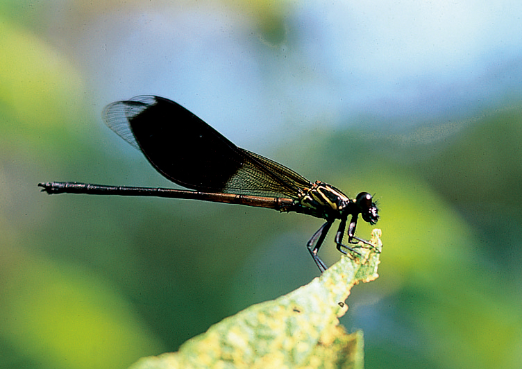
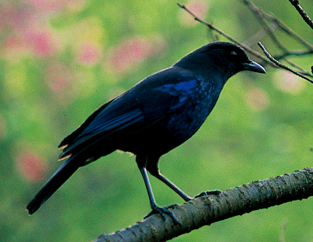
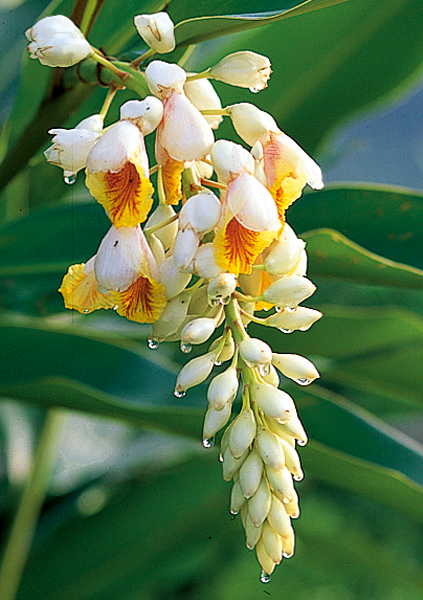
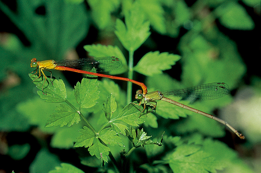
Observations (From iNaturalist)
Trailhead / Trig
Mobile coverage
Observations (From iNaturalist)
Reminders
Go with your companions and don't take shortcuts.
To ensure your safety, please go with your companions, follow the indicators, do not take shortcuts or self-directed routes, and do not leave your team and walk alone.
Carry Global Positioning System and communication equipment
For hiking, please plan your trip and bring enough equipment and food with you. It is suggested that you should carry Global Positioning System (GPS) and communication equipment such as a satellite phone, mobile phone, radio or satellite positioning equipment such as Personal Locator Beacon (PLB), etc., and should carry enough batteries to ensure emergency communication.
Quickly pass dangerous areas
The road condition in the mountainous area is unstable. Please do not stay or take pictures in dangerous areas such as collapsed or falling rocks and pay attention to your own safety at any time.
It is recommended to complete the mountaineering insurance
There are certain risks in mountain activities. It is recommended that you should complete mountaineering insurance before departure. (Note: General travel insurance does not necessarily cover mountaineering accidents. Please refer to the policy details before applying for insurance. For the mountaineering insurance, please refer to the following instructions in Financial Supervisory Commission's press release and choose the appropriate insurance.)
Information on mountaineering safety
For information on mountaineering safety, mountaineering equipment, and tips for using maps, please visit the website http://goo.gl/QUnv12u. It is recommended to read the information before the trip to ensure your outdoor activities are safe.
Travel Guide

Travel Guide
Featured Landscape
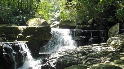
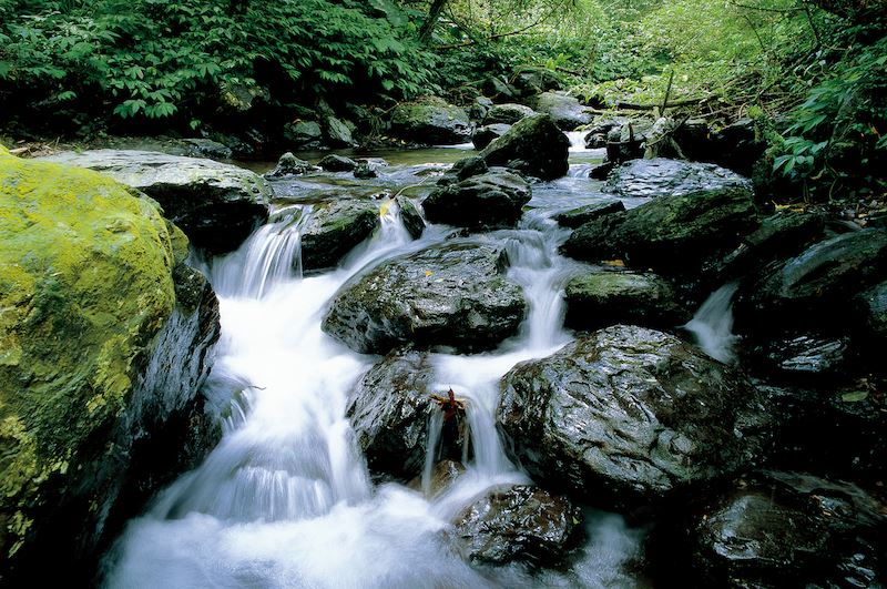
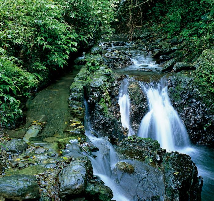
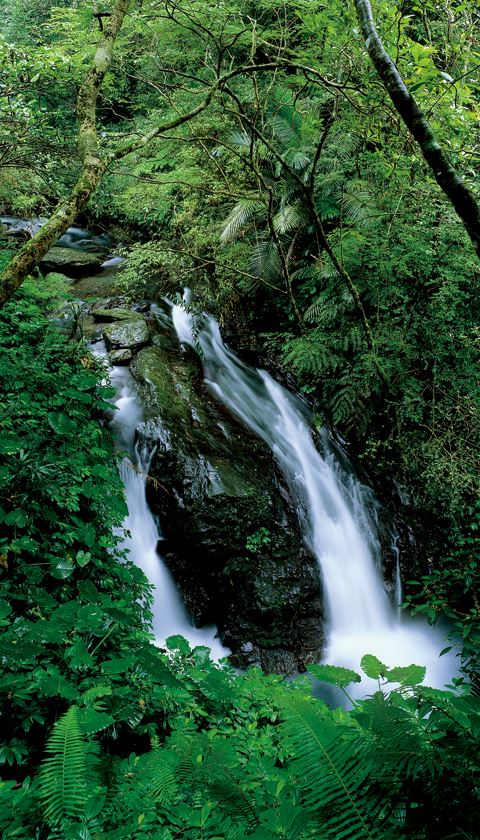
Drink water and remember its source: Visit the ruins of the canal
Source|宜蘭分署
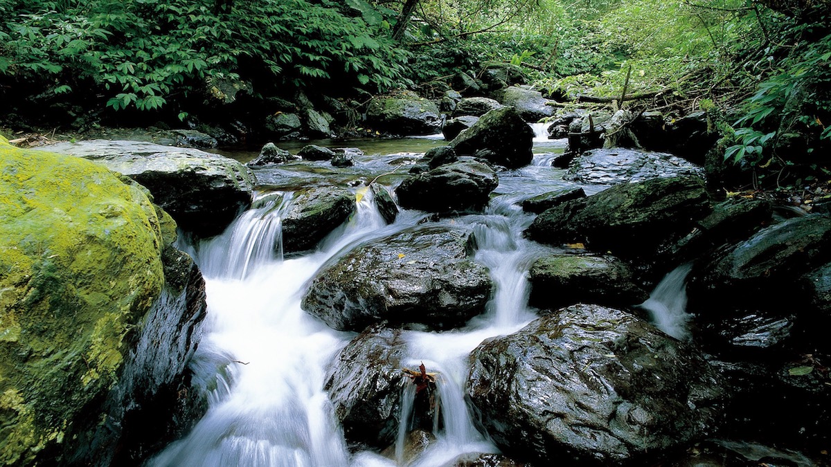
Linmei Village is located at a high altitude and has difficulty in getting water. During the Japanese occupation, a canal was built with stones to divert water from the Shipan Waterfall upstream to irrigate more than ten hectares of terraced fields downstream. This canal road is the predecessor of the Linmei Shipan Trail. The remains of the canal and channel caves can be seen at the stone-hopping section across the stream starting at 400 meters on the trail, and in front of the water intake sign at 520 meters.
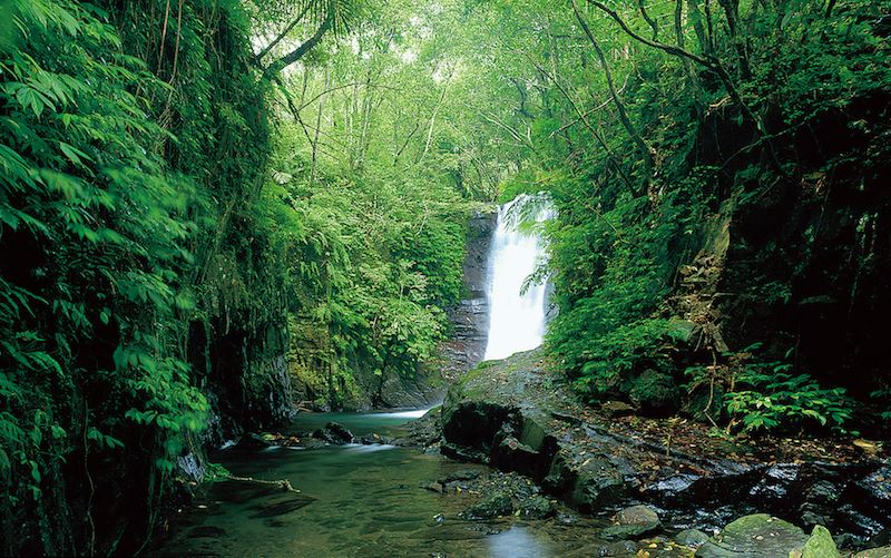
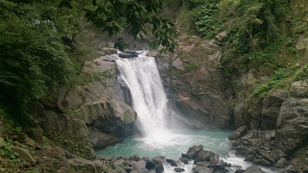
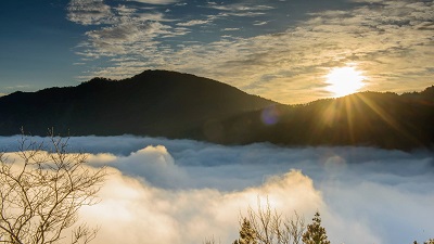
Magnificent scenery, absorb forest phytoncides
Source|宜蘭分署
At 450 meters, there is a U-shaped canyon with canal remains and Dezikou Creek below. The scenery is magnificent and it is known as the "Little Taroko of Yilan". At 600 meters, the wooden plank road has a 70-degree slope, overlooking the cliff of the stream below and the Shipan Waterfall above. The splashing water mist combines with oxygen and phytoncide to produce a large amount of anions, forming "air vitamins" that help purify the blood, beautify the skin, and stabilize emotions. At 900 to 1,000 meters, there are a large number of densely packed Taiwan pen holder trees, which look like green umbrellas blooming among the trees, very spectacular. The dead trunk of the pen holder tree still retains beautiful patterns, so it is transformed into the material of the sleepers and stairs, making walking on it closer to nature.
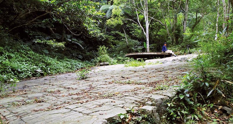
Stone Rocks Tell the Story of Rural Life
Source|宜蘭分署
Above the waterfall is a 300-ping giant rock, which is the origin of the name "Shipan". It is made of ancient, hard four-sided sandstone. If you look closely, you can see crystal clear quartz minerals. Shipan is located at the midpoint of the trail and was a rest stop for the ancestors who entered the mountains to reclaim land. Local elders recalled that when they were young, they often accompanied their elders into the mountains to plant crops such as ginger, radishes, and sweet potatoes, and rested here.
Nearby Attractions